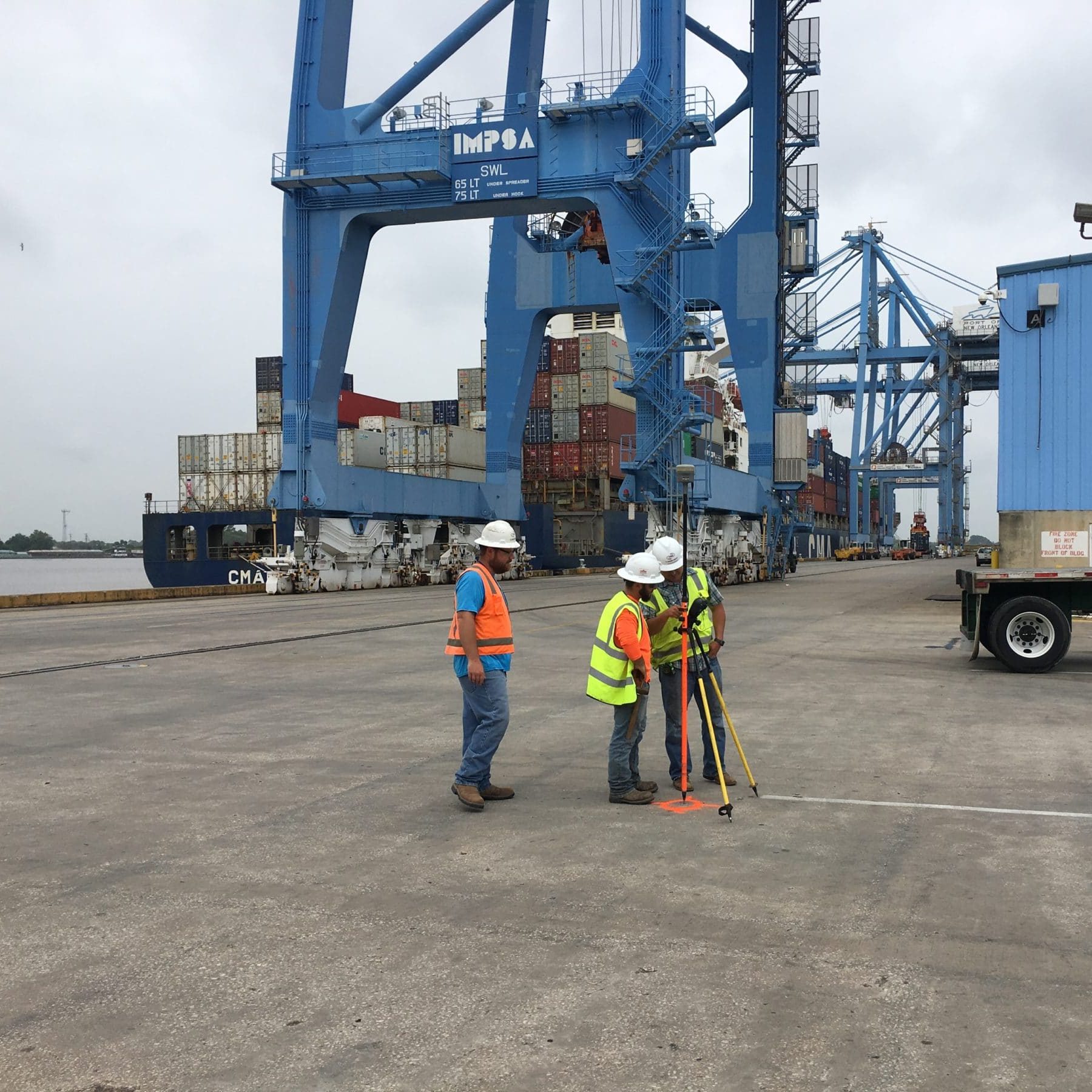
Port Survey & Engineering
Ports
Navigating Innovative Solutions to Sustain Vital Port Operations
TBS understands the economic impact of developing ports for industrial development. Increased trade, capacities, and channels lead to larger vessel size and deeper ports. Updating old facilities and building new infrastructure requires information on site conditions, environmental impacts, and historical changes. TBS provides integrated services for design, permitting, construction, dredging, vessel transit, beneficial use, and monitoring at ports along the Gulf Coast.


Port Solutions
Project Spotlights
See all of our latest projects in our full project portfolio
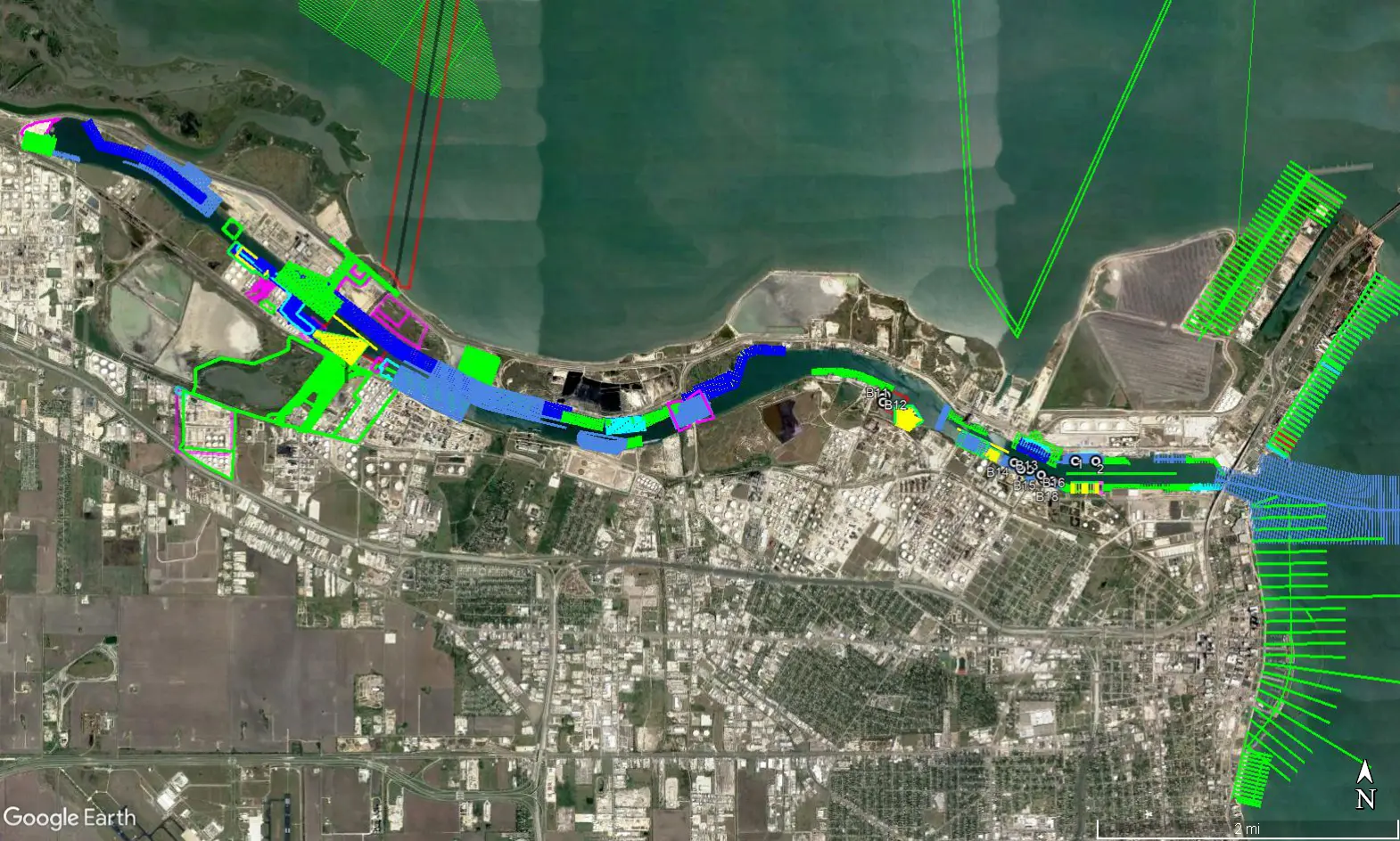
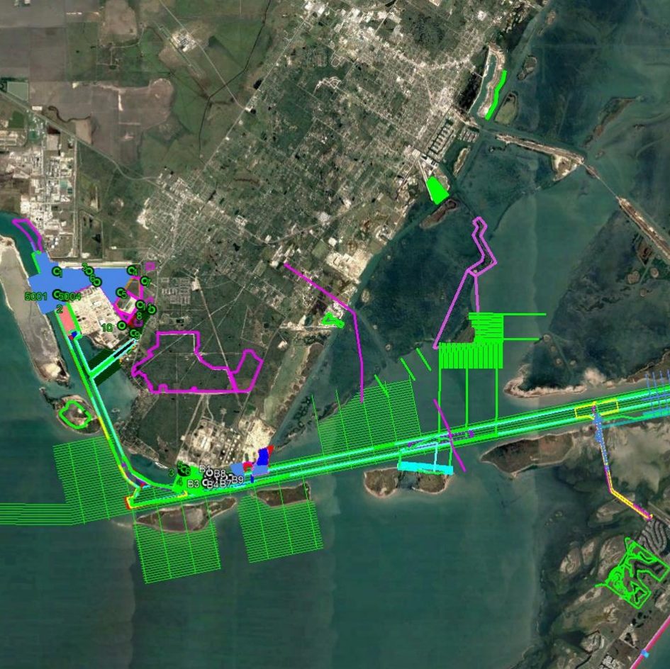
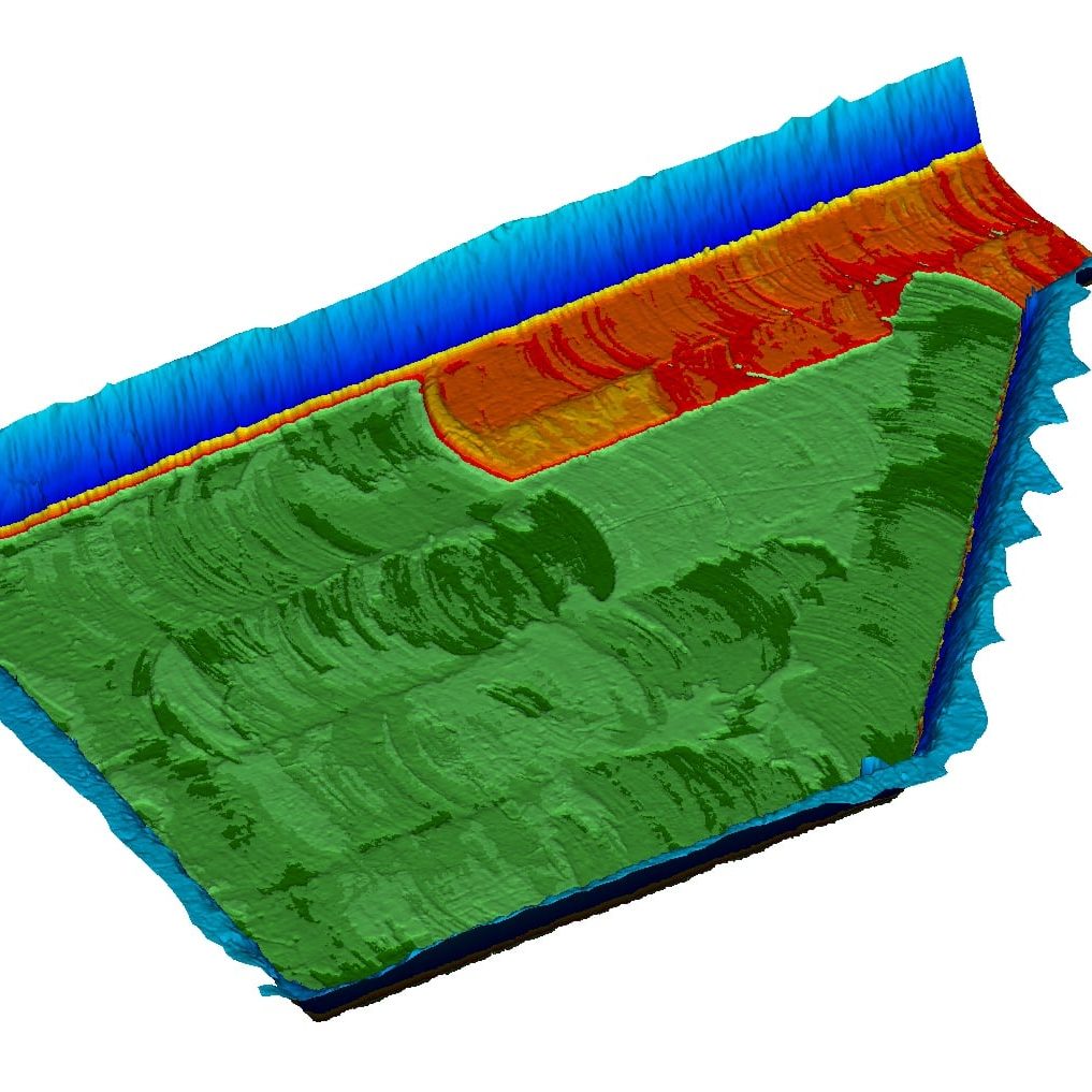
Port of Corpus Christi Dock Surveys and Soundings in the Inner and Outer HarborJennifer Smith2022-11-21T16:31:34-06:00
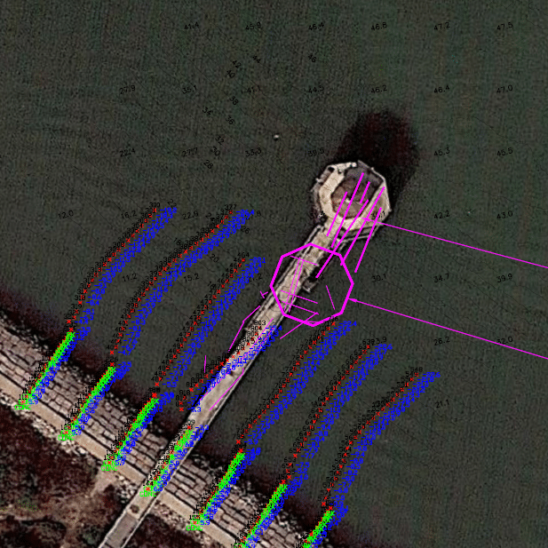
Harvey Rebuild Research Pier at the University of Texas Marine Science InstituteJennifer Smith2022-11-21T16:30:51-06:00
Professional Services
We perform a variety of services for our clients to take their project from start to finish
Air Compliance
Water Quality Compliance & Permitting
Solid/Hazardous Waste Material Management
Coastal and Natural Resources
NEPA and Due Diligence
O&G/Pipeline Regulatory
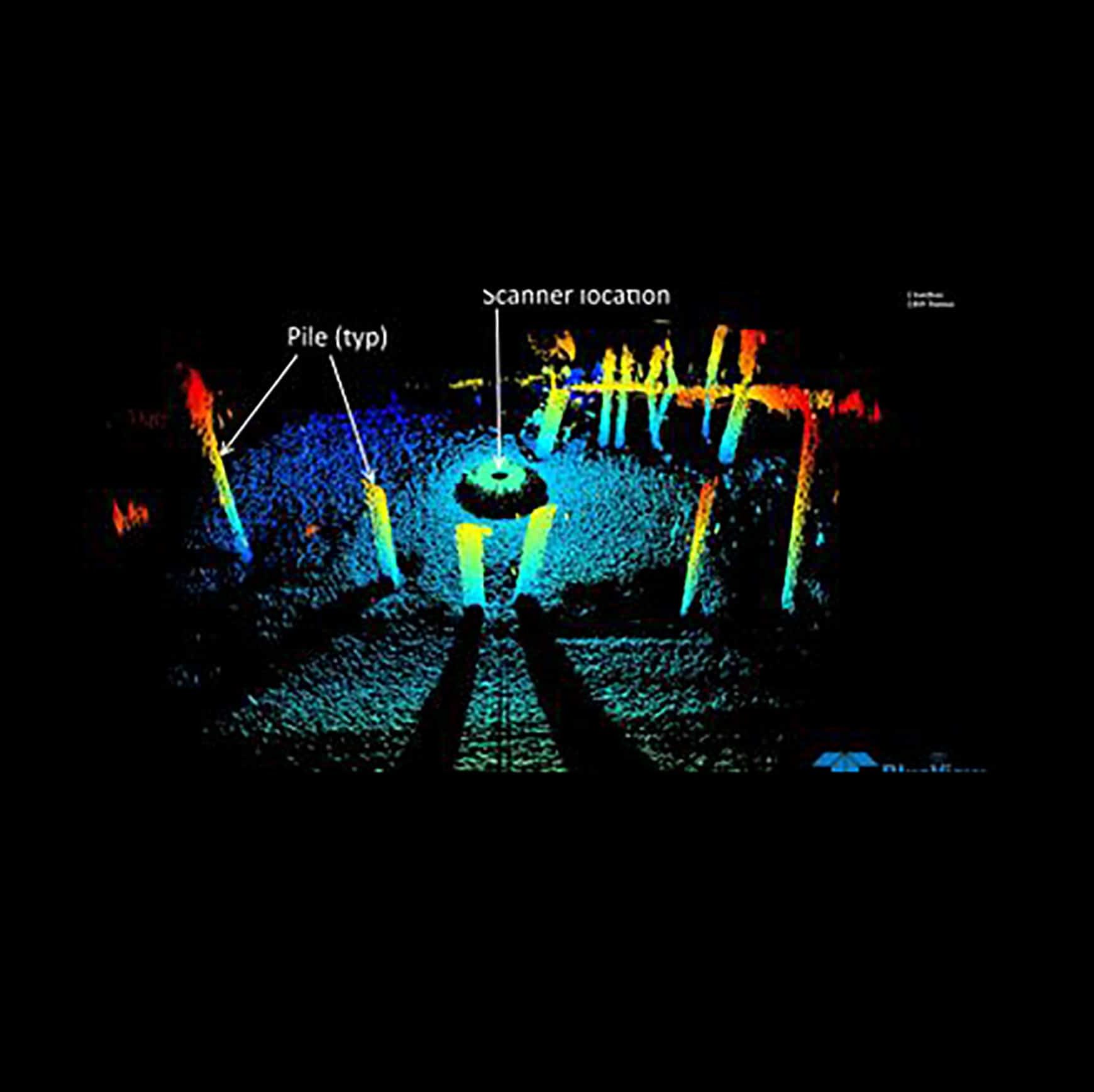
Monitoring and Data Management
Additional Services