Port Nola Terminal Conversion
Public Works – Local
The Challenge
To Be Met
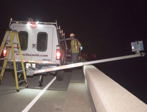
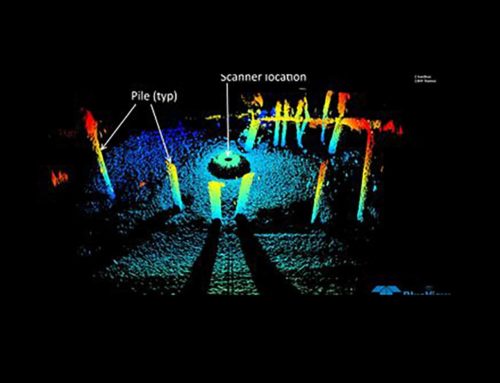
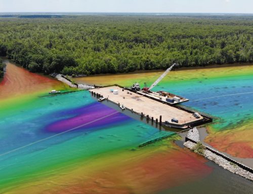
As a subconsultant, TBS was tasked with completing a topographic survey of the topside and sub-deck of the wharf and a bathymetric survey of the Mississippi River adjacent to and extending 180’ under the wharf. However, active daily Port NOLA operations created data gathering and safety challenges for TBS to overcome in producing the survey deliverables required for the design of the crane rail extension. Conventional surveying was limited topside by the constant unloading of container ships and the movement of gantry cranes and container trucks involved with these operations.

The Solution
Our Creative Approach
TBS surveyors developed a solution to capture the data needed for design while fully maintaining unimpeded port operations. TBS created a survey workflow using a duel robotic total station/scanner and RTK GPS to complete a conventional survey of only the absolute critical features (existing rails, utility features, major infrastructure) while performing a terrestrial scan from every station setup to collect additional data needed for design.
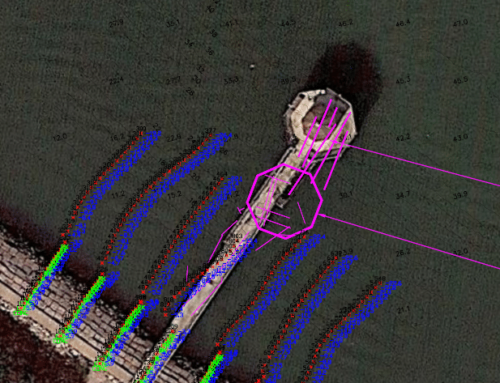
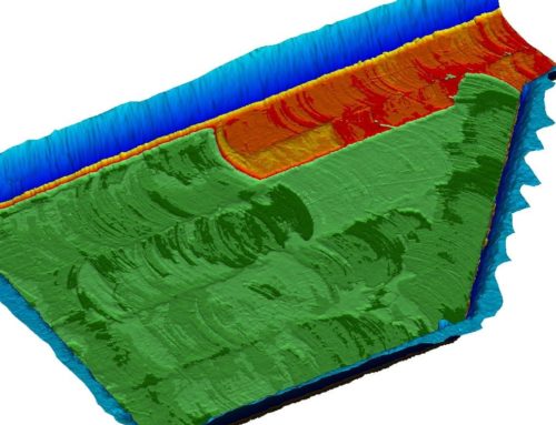
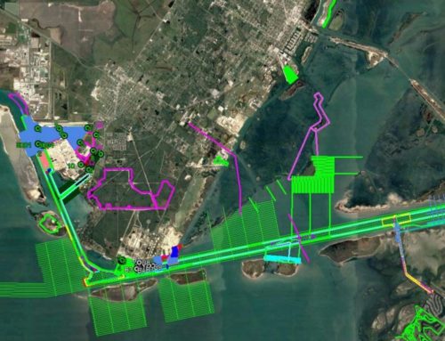
Below deck, TBS utilized the total station and known points tied in topside and visible below the wharf to perform re-section calculations to establish sub-deck control. Using this control, TBS surveyors performed topographic surveys conventionally where accessible and conventional cross sections as far into the river as the survey crew could safely walk. Additionally, TBS utilized a hydrographic survey vessel to perform a multi-beam scan with the scanner head turned 90°, allowing the vessel to scan from the dock side of the river toward the land side of the wharf. TBS surveyors used conventional survey data in areas accessible from the sub-deck of the wharf to verify the multi-beam bathymetric data was accurate to within about 10’ of the water’s edge. Bathymetric data was captured and verified as far as 180’ underneath the wharf. Once all surveys were complete, the conventional, scan, and hydrographic data was processed and merged to form one comprehensive CAD model of the entire project. Through innovation, collaboration, and determination, TBS safely completed the survey timely and efficiently.