Unmanned Aerial Systems
Unmanned Aerial Systems (UAS)
Raising the Bar on Data Collection
Integrating our Unmanned Aerial Systems (UAS) into projects is one way TBS is raising the bar on data collection. This new and rapidly evolving technology allows TBS to safely collect large amounts of data in a fraction of the time. With our growing fleet of state-of-the-art unmanned aerial vehicles and a multitude of processing software, TBS is able to customize client deliverables to satisfy any project.

Our UAS Solutions
Aerial Data Acquisition Capabilities
Surveying Solutions
Find the Solution for You
Project Spotlights
See all of our latest projects in our full project portfolio


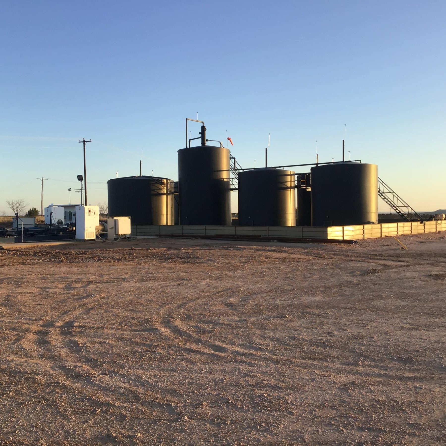
Due Diligence for SWD Facilities and Operational Sites across New Mexico, Oklahoma, and TexasJennifer Smith2022-11-21T16:30:25-06:00
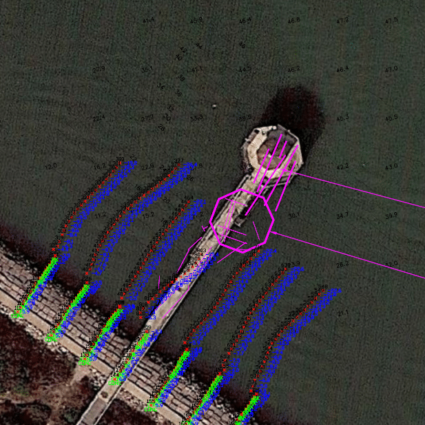
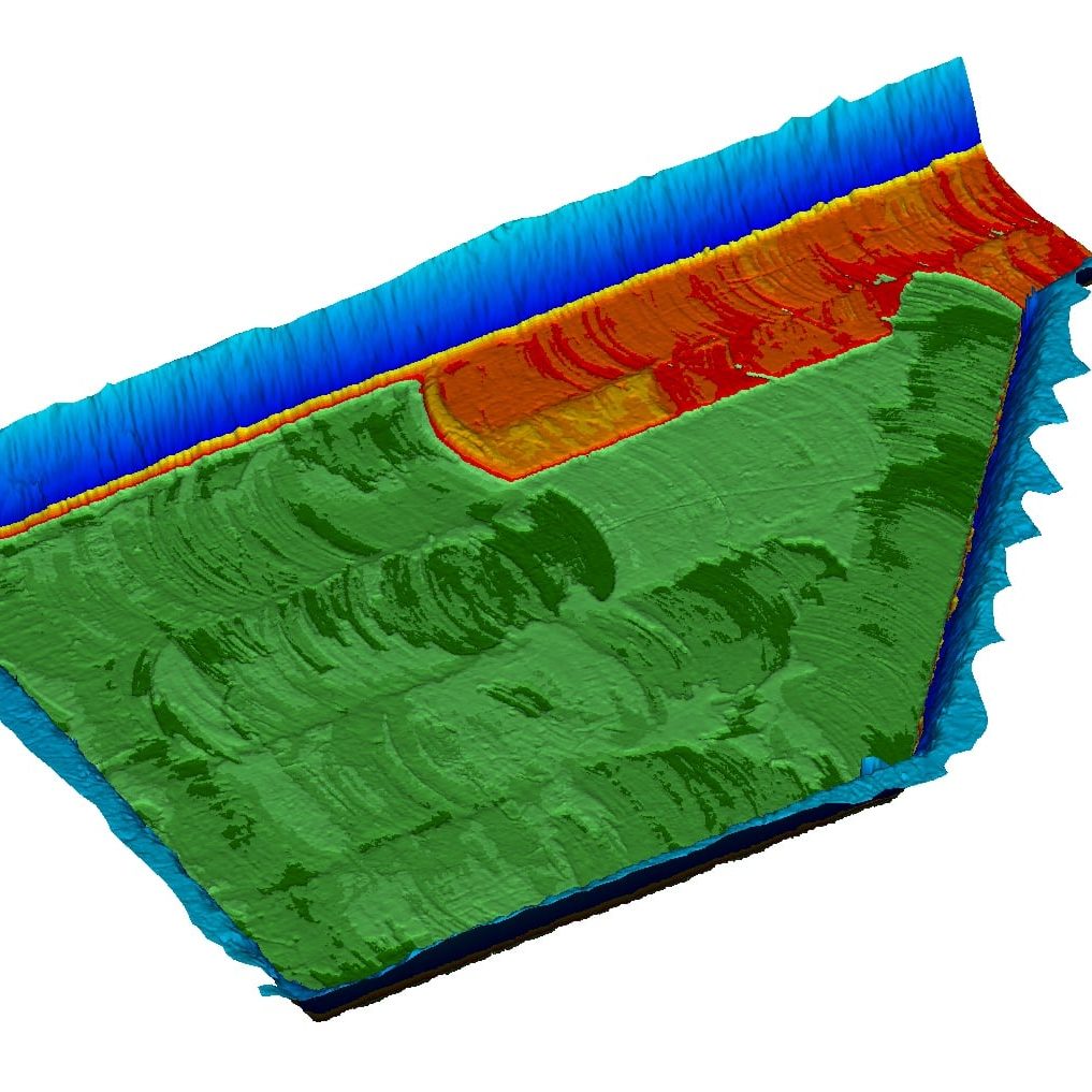
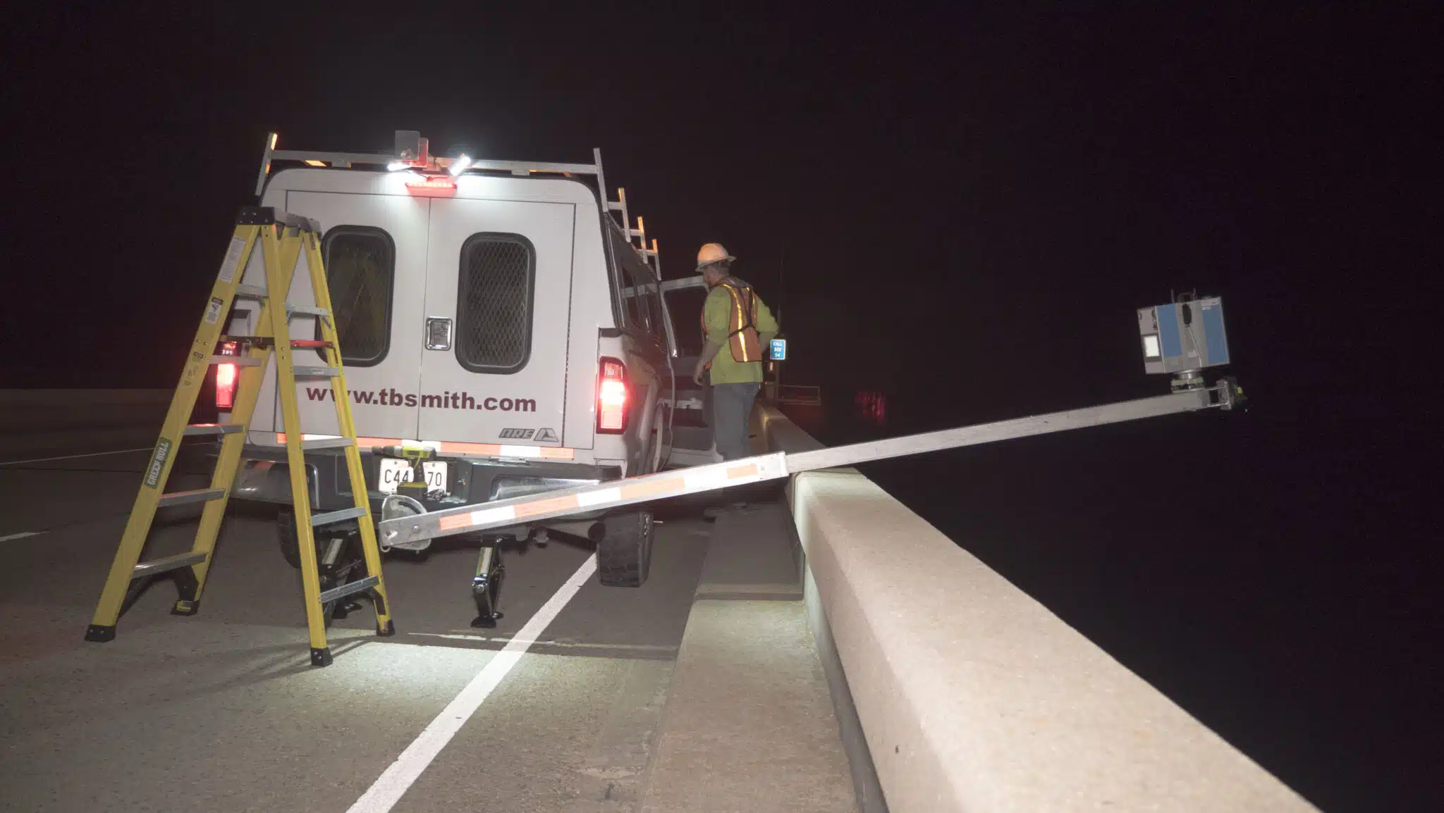
Harvey Rebuild Research Pier at the University of Texas Marine Science InstituteJennifer Smith2022-11-21T16:30:51-06:00